To see the Wikipedia on Cape York, the \”Top\” of Australia: CLICK HERE Thursday Island: CLICK HERE
. Torres Strait Islands: CLICK HERE Torres Strait Islanders: CLICK
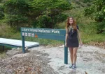
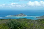
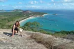
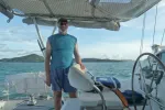
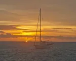
Arrival at Lizard Island Resort & National Park. It was a not too long a day sail from Cooktown on the mainland.
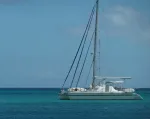
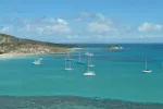
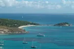
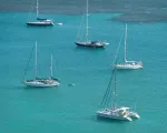
We shared the anchorage with about 20 boats, most of whom were going to Darwin for the Darwin to Kupang Rally
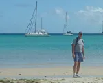
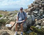
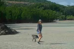
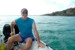
Scott ashore at Lizard Island.
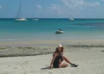
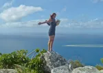
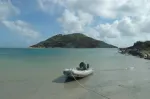
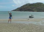
Nikki on the beach – Lizard Island, Australia
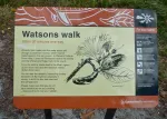
The Watson’s were an unfortunate story. While her husband was of island, local Aborigines threatened Mrs. Watson, her infant child and her man servant. They believed the white man was violating sacred ground. The three fled in a small boat and perished on an island 20 miles away from lack of water.
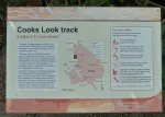
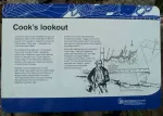
Captain James Cook brought his vessel “Endevour” to this island to ascertain if he was “embayed”. Embayment is where an old sailing ship is trapped due to it’s poor ability to go up wind. He wasn’t, but of course he did not know that. After his almost loss of his vessel, just repaired in Cooktown (now named for him), he was extra cautious and upon seeing an exit to the open sea from Cooks Lookout (Lizard Island), exited the Great Barrier Reef to seaward to continue his journey north.
Cruisers anchorage – Lizard Island
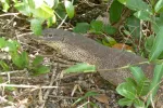
A notable feature of the island….Large Lizards.
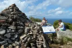
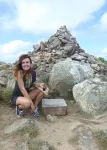
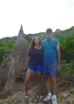
Cook’s Lookout – Delany and Laura from Texas.
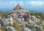
We made the somewhat strenuous hike to the top and saw what Captain Cook saw. This is where he decided to finally leave the Great Barrier Reef.
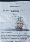
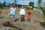
Scott signing the book.
Memorial to Cindy by Scott and Nikki.
Please close the cover….lest the log book be a wash, mate!
Nikki with the book’s container.
Cook’s Lookout
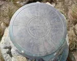
Hard to read, but this obelisk has direction and distance in Kilometers to many cities around Australia and the world.
Back toward Cooktown. Cook actually brought a small sailing craft out here from the shore, not wanting to risk “Endevour” needlessly.
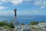
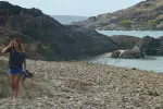
The exit to the reef is 20 miles behind Nikki. Hundreds of small reefs like the one to her right are everywhere inside the “Great Barrier”.
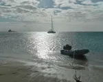
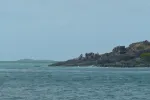
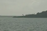
Anchorage at Lizard Island with Resort in the distance.
Nik on a nook….:-)
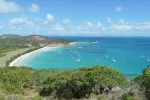
The resort was purported to be 2,000.00 to 5,000.00 dollars per night! The staff wouldn’t give us an exact figure, but said it was “expensive and exclusive”. We were not supposed to venture into the beach seen here in the distance.
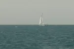
Boats en route to Darwin for the Rally.
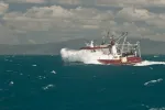
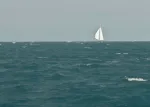
We met “Georgia J” here from San Francisco. They were behind us and we were both surfing down the conditions seen in the following photo sequence.
As you can see. We were glad to be going WITH the wind.
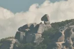
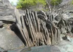
An interesting coast. Note the boulder at the top of the cliff.
Boulder up close. This coast had a host of interesting geology like this. It looked as if someone picked it up and placed it on top of the smaller rock.
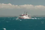
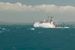
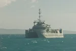
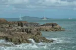
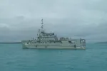
Australian Navy Survey vessel. We were en route to find an anchorage at Flinder’s Island when we passed this vessel at anchor. It is constantly updating the Aussie coast surveys to update hazards and charts. It’s sister, “A02” was to our right and we would see her again at Thursday Island in the Torres Straits off “The Top” of Cape York.
Morris Island Bight and anchorage. We had to break up our long voyage from Lizard Island to the Escape River and read about this anchorage in the guide. We shared it with a big tug in the distance.
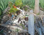
We read of a “divers grave” (pearl diver from a by gone era) at this island and we did indeed find it.
Part shrine, part rubbish. In disrepair, it seems all manner of sailor has left everything from pearl oyster shells and bottles of bear to unfortunately….a bit of rubbish.
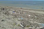
Windward side…. Also of note is that on the windward side of most islands inside the Great Barrier Reef, we saw nothing but rubbish.
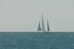
Just as we were entering the “Escape River”, we saw the Amel 54 s/v “Shapirit” sail by en route to Darwin.
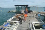
We anchored in the escape river and met Rusty and Bronwyn. They own the pearl concession here and were working their areas when they came by to see us and warn us about CROCS.
Their puppies have to be on the lookout as there were three crocodiles within sight of where I took this photo. One, 4 meters long! They just had their eyes above the water, so the photos weren’t of much use.
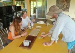
Rusty and Bronwyn teaching us a bit about pearls. Yes…we did buy some. Earrings and a pendant for Skye and a nice one for a necklace or pendant for Nikki. (I gave it to her for her birthday several months later!)….
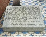
Japanese Pearl Divers originally worked this area and this is a marker to those times. Many of them perished from the “Bends” which was not well understood for a long time. Once it was, the divers pushed the limits in search of treasure, but alas, many were lost.
Rusty, Bronwyn and Nikki – Turtlehead Island. There were two 8 foot crocodiles 50 feet behind me when I took this photo!
Departing the Escape River for “The Top” at Cape York.
Scott in the Escape River. The river was called “Escape” by Mathew Flinders when he felt it would be the place he would escape the Great Barrier Reef from.
MR. JOHN VI….we finally meet. Though we’d been in email contact for years, John & Paula Westenholme were now new friends in the flesh.
Mr. John VI, following Beach House to “The Top”.
Anchorage just west of “The Top” – Cape York, Australia.
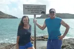
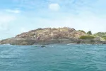
Possession Island in the distance. Were At “The TOP” – the most northern place on the Australian Continent.
Nikki minded a friend for a new friend.
This is a bucket list item for most Aussies. They all want to say, they’ve been to “The Top”.
Sea worn stones at the top.
The official placard.
Anchorage just west of “The TOP” – Cape York, Australia.
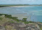
At high tide, this beach is completely underwater. We started experiencing large tide swings once we rounded the top. Up to 22 feet in Spring Tides!
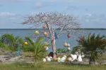
Termite mounds are all over Queensland and the NT (Northern Territory).
Nikki landing at the Top. Possession Island in the distance.
The ritual continues. It was non stop all day. This is NOT an easy place to get to for the average person. It requires an airplane ride for starters.
Possession Island with “The Top” and crowd in the distance.
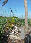
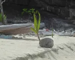
Coconut tree formation.
Scott with the TOP tourists in the distance.
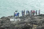
Really…this went on for hours. Group after group.
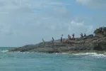
Tourists at “The Top”.
Lots brought their Aussie Flag for photos.
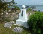
Monument to Cook’s landing.
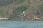
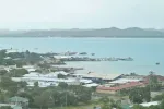
Small harbor at Seisia. Fishing boat wreck. Shallow enough to walk around waist deep.
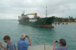
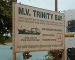
M/V Trinity. The local cargo vessel as the roads are often washed out here in the Summer Rainy season. This is the small town of Seisia’s life line to the outside world.
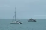
Beach House with Ferry. This is one of the small day ferry’s that go on the one hour trip to Thursday Island in the Torres Straits.
We took the Ferry and were lucky to get seats. It was sold out for days and we got on standby.
Not sure what to make of this conflicting sign. We are in the heart of the Aboriginal tribal lands.
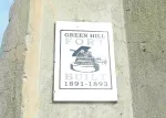
Green Hill Fort was built in 1893 to thwart a Russian invasion. Go figure. It was extensively used in WW2 as an ammunition depot.
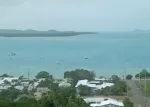
Thursday Island – s/v Uliad in the anchorage. Old friends from the Marquesas, Steve, Kathy and son Emmett abroad. We would not meet up till Darwin.
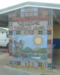
Thursday Island is one of the islands named for the day of the week it was originally discovered. There is also Friday and Wednesday Islands.
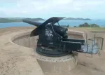
Gun at Green Hill Fort.
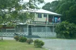
This is the northern most pub in all of Australia. The double entendre of the “Top Pub” is duly noted.
Japanese pearl divers worked this area for most of the early 1900’s till the start of WW2
Spanish navigator Torres was the first to sail these waters. It is the Eastern juncture of the Pacific and Indian Oceans.
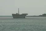
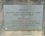
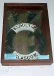
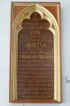
SS Quetto disaster.
131 people were lost in minutes when “Quetta” hit an uncharted reef in the Adolphus Channel in 1890.
Site of the loss of “Quetta”. She is one of hundred of vessels lost along the Great Barrier Reef.
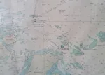
Map Graphic of Papua New Guinea to the north and Cape York, Australia to the south with at least 25 major islands and reefs in the Torres Straits.
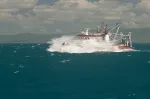
Australian survey vessel “A02”. A catamaran hull to keep her draft shallow, she surveys vast tracts of the Great Barrier Reef to identify hazards and improve navigation.
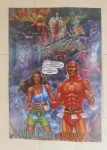
Sign of the times…. Poster in the very small town of Seisia, targeting Aboriginal youth to practice safe sex. I guess they know their youthful audience?…..Nuff said, enjoy!