To see the Aboriginal Yirrkala Art Centre – Mukla Project near Gove: CLICK HERE
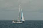
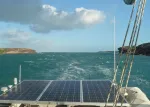
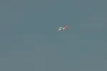
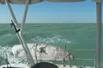
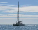
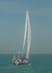
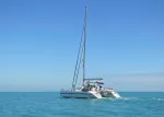
Mr. John VI arriving Sesia, Australia (just west of Cape York and south of Thursday Island in the Torres Strait).
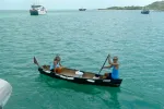
Paula & John coming by for a visit. Sesia, Australia. From this anchorage is where we took the Ferry to Thursday Island.
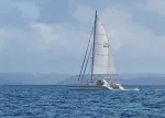
Departure from Sesia to Gove, Australia
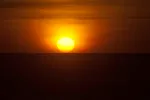
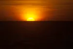
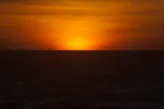
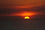
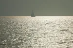
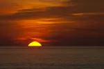
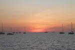
A lovely sunset beginning in the smokey haze of the NT (Northern Territory)
This time of year, the Aboriginal tribes are burning off vast acres of bush.
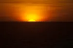
Though lovely in it’s own right, we’re always looking for the famous “Green Flash”.
Keep watching….
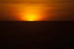
I was about one half second too early, but if you look closely, you’ll start to see the green coloration from the spectral diffraction that causes many sunsets to display the Green Flash. A blink after I took this photo, the green really stood out.
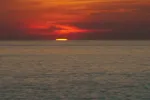
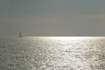
Another lovely sunset in paradise…:-)
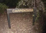
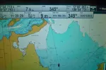
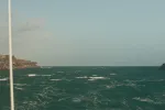
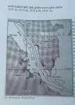
It was about 600 miles across the Gulf of Carpentaria (not to be confused with the home base of Carpinteria, California).
The Gulf is noted for it’s steep chop due to being very shallow for hundreds of miles. Crossing the top of the Gulf can be problematic, but our passage was a pretty easy 2+ days.
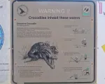
Signs of the times….and place. Crocodiles are everywhere along the NE of Queensland and the entire Northern Territory coasts. Queensland and the “NT” are way bigger than Texas!
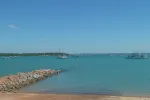
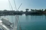
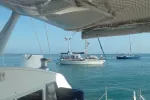
Anchorage at Gove….at low tide, it was 7 feet deep. At high tide, near 21 feet.
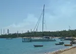
Careening stand…. This cat at low tide was on the sand. The stand off his port bow is for monohulls to secure to. There are no haul out facilities here and due to the extreme tides, you can tie up to this structure and have your boat stand up (keel boats) to paint or service the bottom.
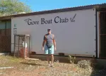
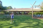
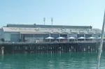
Gove Boat Club grounds.
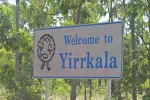
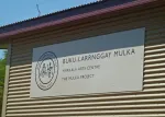
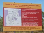
Yirrkala is an area near Gove which has a large landholding indigenous population. The highest density of Aboriginies is in the “NT”.
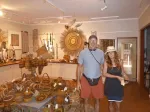
Yirrkala Art Centre – Mulka Project
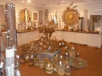
This was a delightful art center where our friends Jeff & Gayle of s/v “Lazybones” had been three years before us.
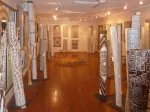
Indigenous Artworks
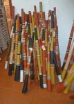
Scott’s favorite – Digeridoo’s!
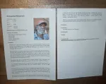
Selected Digeridoos had the artist bio and the history of the instrument to go along with your purchase.
Yes I bought one…..In fact, while in “OZ”, I collected eight digeridoos. Nikki got a few too!
All the “Dig-ges” I bought were of high music quality.
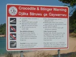
Croc’s and Stingers. Stingers are the infamous “Box Jelly Fish” which is potentially one of the most deadly animals in the world.
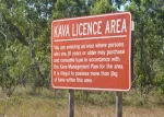
We didn’t know we needed a permit for the day trip and were told if we saw an official looking vehicle to just drive the other way. No worries, no problems.
Like the peoples of the South Pacific, Kava is used as an Aboriginal potion as well. Aboriginies are missing the genetic means to digest alcohol efficiently and need to watch consumption.
We guess Glue and other aromatics are an issue with youth in this area?
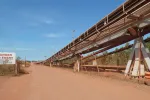
Aluminum mine… This is a conveyer to move the raw bauxite to the shipping terminal which is far and away the biggest employer in the entire area for hundreds of miles.
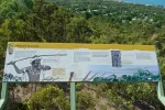
We finished our tour in the town proper and learned of many Aboriginal legends.
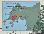
The anchorage is in the far upper right corner below the peninsula (green area) and many parts are considered sacred land in the Aboriginal culture.
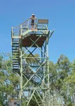
Overlook of Gove
This overlook had it’s own legend which was on this story board.
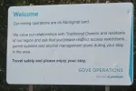
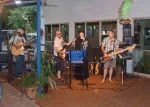
Meanwhile….back at the club. This was a social center for many of the Gove residents and they had live entertainment on Friday and Saturday nights.
Off on a truly unique trail…..
Most people who sail “over the top”, go to the north part of the Wessel Islands. Many go through the “Hole in the Wall” too.
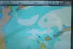
Our AIS is showing an approaching cargo vessel. It’s the small triangle and we’re the larger boat icon.
Here, the image shows us passing, “Port to Port”. We confirmed on the VHF radio.
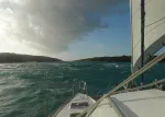
Here’s the real world picture.
Approaching “Hole in the Wall”. This is a passageway between two islands where the extreme tides of the area cause quite a current and rip. Under some circumstances it can have large standing waves and be dangerous.
You can see the wave fighting the current. We entered at high slack tide and it was still a bit of a bumpy ride.
Hole in the Wall
A small inlet where we think you could anchor, but as we were basically hundreds of miles from anywhere (Gove now about 70 behind us), we weren’t interested to see if we could get in any trouble.
Australian Customs… This would become a familiar sight and we were hailed on VHF radio about 5 times in our crossing over the “Top”.
They could see us on the AIS so they knew who we were and would call us by boat name. There is a very active coastal watch as Australia has an illegal immigration problem from the North.
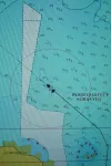
It’s always a bit trepidous when one sees “Inadequately Surveyed” on your charts. We did see several areas like this, but were for the most part never in them for more than minutes.
When we entered the Yabooma Inlet, we discovered why very few boats take the coastal route along here. Rivers with big tides, fast currents and lots of mud. Also, the entrances are tricky and shallow. Maneuvering against the current while trying to anchor, we sucked up a lot of mud and our starboard engine blew it’s impeller for the raw water pump. Fortunately, we had plenty of spares and I knew immediately when the engine overheated what the issue was. New one on the left…..
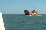
m/v “Victoria Tujus” on it’s weekly run to bring supplies from Darwin to the local folks. Coming by big rig truck is much more problematic and in the rainy season (which it was not), the roads are all dirt and washout.
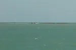
Reef entering Yabooma Inlet…. This reef was completely underwater at low tide! Watch the charts…watch the water. The charts were surprisingly good.
Due to the several inlets and shallow waters along this coast, the water color was this pea soup green for a few hundred miles.
The white area had NO surveys. No worries, no problems.
As the Aboriginals were in full burn the bush mode, many sunsets took on this deep rust color.
Mr. John VI went north through the Wessels, but rejoined us just before entering the “Bowen Passage” along the Cobourg Peninsula. Darwin was on the west side of this peninsula – another 100 miles or so.
We had a guide book to assist us in this passage with Crocker Island to the East and the Cobourg Peninsula to the West.
The charts mostly showed….not much. We got down to 13 feet once, but again, no worries, no problems.
Passing Mr. John VI as we entered the passage. Everyone likes Beach House to “go first”….radio back…:-)
Beach House approach Coral Cay Resort.
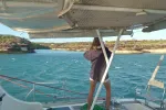
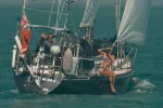
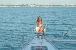
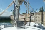
Nikki & Scott
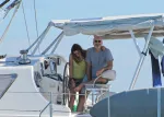
John & Paula Wolstenholme aboard “Mr. John VI”.
John & Paula.
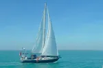
Beach House
Sunset from Coral Cay anchorage.
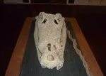
Crocodile Skull – Coral Bay Resort
Departing at 5 am from our last anchorage on the Coburg Peninsula for the 85 mile trip to Darwin. The current had to be hit right. We saw speeds up to 15 knots over the ground when it was with us!
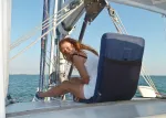
Nikki relaxing as we arrived at the Darwin Sailing Club anchorage.
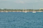
The “Darwin to Kupang Rally” participants were starting to arrive. We had over 100 boats when we arrived.
The rally wouldn’t start for another two and a half weeks.
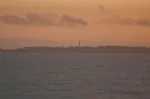
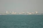
Darwin Skyline (still in the haze – from bush fires in the area).
Anchorage – Darwin Sailing Club
We got a random call from an old friend who needed a tow from the Customs Dock outside the Cullen Bay Marina lock to the anchorage.
Bob and crew on s/v “Sisutl” (last I saw him was in Los Angeles, 4 years ago), had some engine troubles. So we gave him a tow.
Heading for the Docks and Locks of “The Duck Pond”….. Welcome to Darwin.
Nikki and I pretty much had to handle the lines by ourselves, but the lock operator was very helpful.
After a few days, we moved into the “Duck Pond”. This is one of the four marinas in Darwin, all of which have locks to enter.