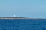
Arrival at “The Top”, Cap d’ Ambre Light – Madagascar
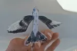
Everyday, one of our first duties is to clear the decks of the flying fish.
Flying Fish detail.
Nikki collecting the daily catch.
Typical day …. after we left Salomon Atoll, we went to Perros Banhos Atoll 35 miles to the west. It was a nice one day stop, but not as comfortable an anchorage, so on we pressed after one day.
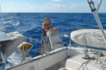
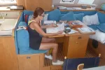
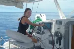
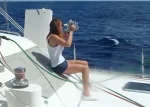
Nikki working out our “line of position” using HO 249. She read Captain Ketriges book, “10 Simple Steps to Celestial Navigation” and quickly learned the fine (and now historic) art of how to navigate by the sun and stars without a GPS!
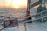
Taking the morning shot
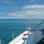
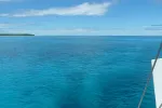
The dark patches can be clouds…..or coral.
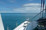
Our electronic charts were very accurate here, but prudence always dictates a good dose of “eye ball” navigation.
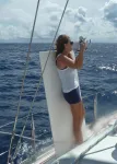
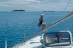
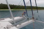
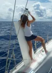
Nikki drove some while I watched for coral.
Captain Scott on the lookout.
Nikki watching for coral “bombies”.
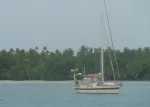
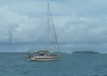
Sunflower – we hope to meet again in Madagascar (we did!)
Getting ready for our departure. Ideally we wanted a slack high tide and overhead sun.
Beautiful sunrise – Salomon Atoll.
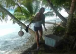
Nikki cleaning her shoes after the “mud hike” through the jungle.
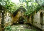
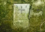
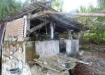
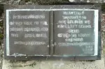
Dedication of the Church in 1935.
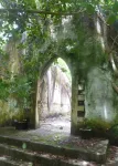
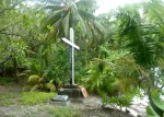
Church entry way
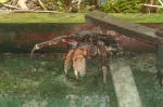
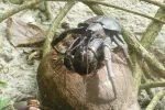
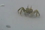
Coconut crab goes to church.
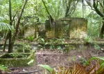
Island touring… we found buildings that dated back to the early 1900’s.
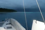
A much nicer day.
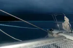
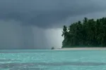
We had one night with hard squalls up to 40 knot gusts in our 12 days here.
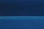
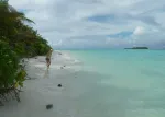
Dark Sky above, Blue Lagoon below.
The Cyclone that formed to our southwest was the strongest early season one on record. It was not as big as “Sandy” in the US, but just as intense.
Nikki with her “5 O’Clock Somewhere” glass of red.
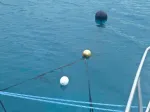
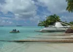
There were a few moorings here which the BIOT wanted us to use if possible to minimize reef damage from anchors.
After a long hard day at work….:-)
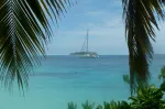
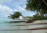
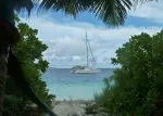
Sunflower – Salomon Lagoon
Beach House – Salomon Lagoon
Lagoon tour by “car”…..:-)
While we were here. Cyclone Anaia formed 200 miles to our SSW. These were formative squalls in the ITCZ.
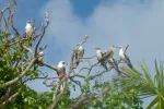
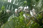
Boobies
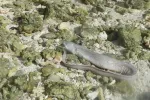
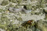
Ile Mapou – After “lunch”, he slithered back into the waters of the lagoon.
Ile Mapou – Conger eel in tide pool. We heard a commotion and thought at first it was trapped. Then we saw it devour one crab and pull the claw off another.
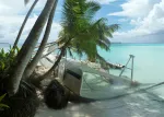
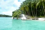
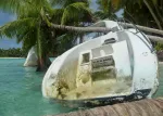
Ile Fouquet – The Wreck of the “Black Rose” across the lagoon from Boddam Island.
BIOT (British Indian Ocean Territory) is the administrator of these islands. They made one visit and knew that we both had permits. Very nice folks, their primary purpose is to enforce the 200 mile no fishing zone around the group which is a huge nature reserve.
Unfortunately, as remote as this island group is from the rest of the world, hundreds of pieces of plastic debris finds it’s way to the outer lagoon beaches. Over the years, cruisers have collected some of it in decoration.
Nikki found this swing hung in the trees and gave it try.
Sports equipment left for the adventurous.
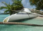
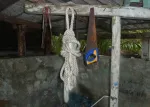
Rigging off lost sailboats. Several have been lost here. There was evidence of at least three on a nearby atoll across the lagoon.
If you need to borrow a tool…..go for it.
The now defunct US magazine, Latitudes and Attitudes house flag was amongst the many.
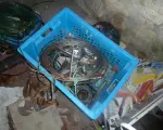
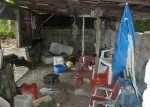
Cruisers junk. Ship wrecked boats have been scavenged and many pieces have been left here.
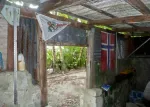
Infrastructure – such as it was over the 50 years since these islands were last truly inhabited.
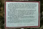
Rules of the island…..
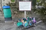
Cruisers Shrine…. Those before us, collected lost at sea flip flops and made a sort of shrine out of them.
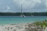
Beach House and Sunflower were the only two boats here during our stay. Less than 40 boats this year had permits to be here.
Nikki and I got a bit lost on this hike so we followed the beach as best we could, but still had to cut through some serious jungle.
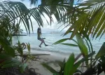
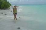
Nikki and I on an island hike. Small islets of the outer reef make up this tropical wonderland.
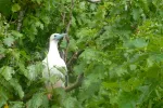
Local Resident
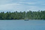
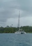
Beach House – Boddam Island – Salomon Atoll Lagoon
Signs of life….
Boddam Island – Salomon Atoll: Signs of life from long ago. These islands were inhabited by various islanders of the Indian Ocean 50 years ago. Today, they are uninhabited except for the US Navy’s super secret base at Diego Garcia. Diego Garcia is 80 miles south of where we were at Salomon and Perros Banhos Atolls.
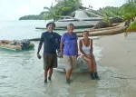
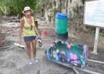
Arrival at Chagos. Our first meeting with Kathie and Dave of “Sunflower”. There from, but as you can tell….”Not in Kansas anymore Toto”…:-)
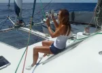
Nikki would plot two “lines of position” and advance the morning line to the afternoon line, giving us a running fix. She was always within 5 miles which out in the middle of the ocean is pretty good.
Taking the afternoon shot.
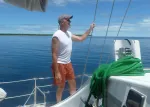
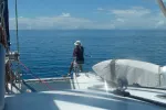
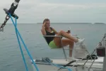
Nikki wanted to navigate the old fashioned way using a sextant and the sun. Here she is seen “bringing down the sun” to the horizon through the sextants mirrors and sun filters
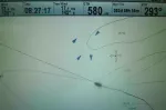
When we left Cocos, we initially had quite a bit of ship traffic which surprised us. We’re the big black ship icon, the 4 others are big cargo vessels.
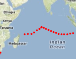
Our “Ship Trak” from Cocos Island off the NW coast of Australia to Chagos Archipelago (Mid Indian Ocean) and on to Madagascar. We stayed well south of Somalia (between Tanzania and Ethiopa). We cleared our route with NATO’s “Ship Watch” program before we departed Indonesia.